Segment 6 — Kenosha Pass to Goldhill Trailhead
Distance: 32.9 miles
Elevation Gain: 5,196 feet
Segment 7 — Goldhill Trailhead to Copper Mountain
Distance: 12.8 miles
Elevation Gain: 3,674 feet
We section hiked these segments with friends from Wisconsin who weren’t acclimated to the elevation. We hosted 2 extra guest in our house which made it seem tinier than ever! One slept in the kitchen while the other slept in the van. I think our max capacity may be 4 extra guests at once. Prior to our backpacking trip, we all went on a day hike at the Mount Falcon Open Space to help them acclimate with the elevation. We chose this hike for its location and good incline for training.
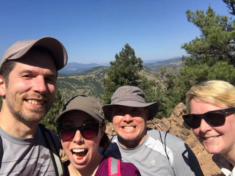
Training hike for the Wisconsin flatlanders at Mt. Falcon in Denver.
We drove to Frisco on Sunday evening and rented a room at the Summit Inn. Neat little hotel with free basic breakfast and close by to the bus station which made the shuttling logistics easier.
Monday morning, our friend Casey was kind enough to shuttle us to Kenosha Pass where we started our hike. If you don’t have a kind friend to drop you off like we did, you can always make a reservation with a local shuttle that is hiker friendly. Here‘s his information.
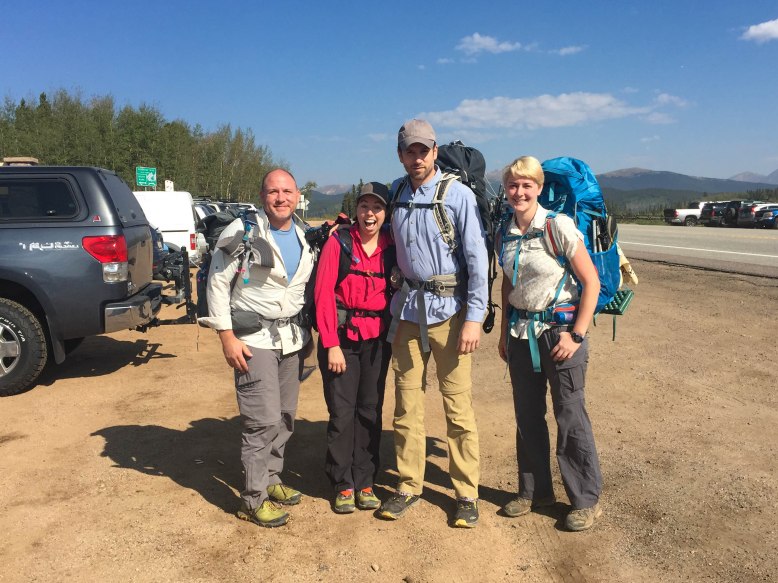
All clean and ready to hike, starting at Kenosha Pass.
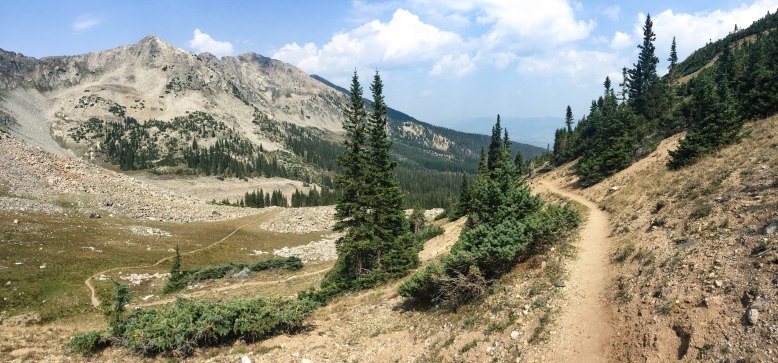
Kenosha Pass is easy to access and a popular spot but we were fortunate that there wasn’t many people on a Monday morning. We slowly gained elevation and made it to Georgia Pass, our first ‘above treeline’ view of the trip. After a few minutes on top of Georgia Pass, we were greeted by mountain goats and their little ones. They didn’t seem afraid of us and got fairly close. The weather was perfect and got sunny blue skies for most of our time on the trail. The second evening at dinner, Michelle shared treats with the group: Astronaut ice cream! A surprisingly good treat. Although packaging was a lot bulkier than the item, I’d recommend repackaging it up if possible to save on space in your pack.

Mountain goats on Georgia Pass.

Astronaut Ice Cream. Surprisingly good.
The overnight lows were between the low 30s and high 40s. Daily average was about 60-70s which made for perfect hiking weather. We could of use a bit more clouds as some of us got sunburned despite applying sunscreen often.
We met a few section hikers on our hike. We kept leapfrogging the same hikers so one from Kansas decided to give us nicknames. Kevin became Ansel Adams because he was the photographer of our group. Michelle became Mary of the Little House on the Prairie because of her flowery shirt and bandana. Bryan became Slick because of his constant efficient & effortless look and composure despite hiking. And I became Rizzo from Grease as I hiked at the front of our ‘pack’ and also wore a bright pink shirt. As a whole group, we became the pink ladies. Haha!
On the third day we decided to hike a bit further than our planned daily mileage to hit a road near Breckenridge and go to town for burgers and beers! As it turned out, it was a fantastic idea. The great thing about hiking these two segments is that the area offers a free bus service between towns which the Colorado Trail crosses a few times. Little did we know the previous day was Kevin’s birthday (Thanks Facebook for the reminder!) so we got him a free desert at the restaurant and ‘celebrated’.
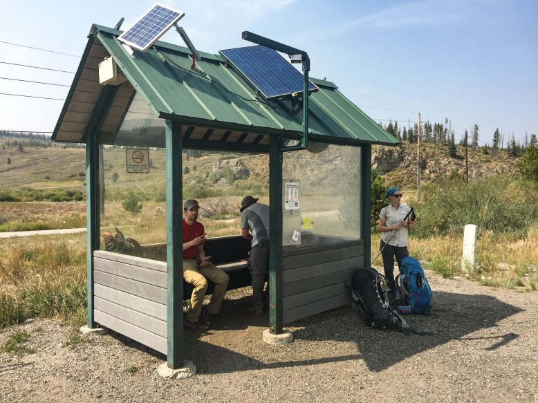
Free Summit Bus to Breck/Frisco/Copper Mountain.
I believe the furthest between water source was about 8miles which wasn’t bad at all. All sources listed on both the CDT and CT Guthook app were all present. Although some were much lower at this time of the year, but still enough to scoop out and fill our water bladders.
We hit a burned area just before heading up the Tenmile Peak 4. Unsure if this was either a controlled burn or a wildfire that was later put under control. Either way, it created a surreal scene as we headed up to 12,500ft from 9,900ft. We weren’t above treeline for very long but enough to soak in the views despite some wildfire smoke.
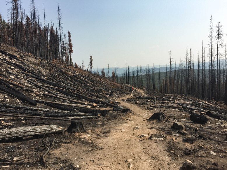
Surreal Scene.
Our last night on the trail was on our way down to Copper Mountain from Tenmile Peak 4. Very few spots were adequate to camp as it was mostly all switch backs or steep downhills. Bryan and I arrived early while Kevin aka Ansel Adam spent a lot of time taking photos on top of Peak 4 while getting caught up in a quick hail storm. Thankfully, all went well and he made it down safely.
Starting to be above treeline. Fat marmots could be seen sun bathing.
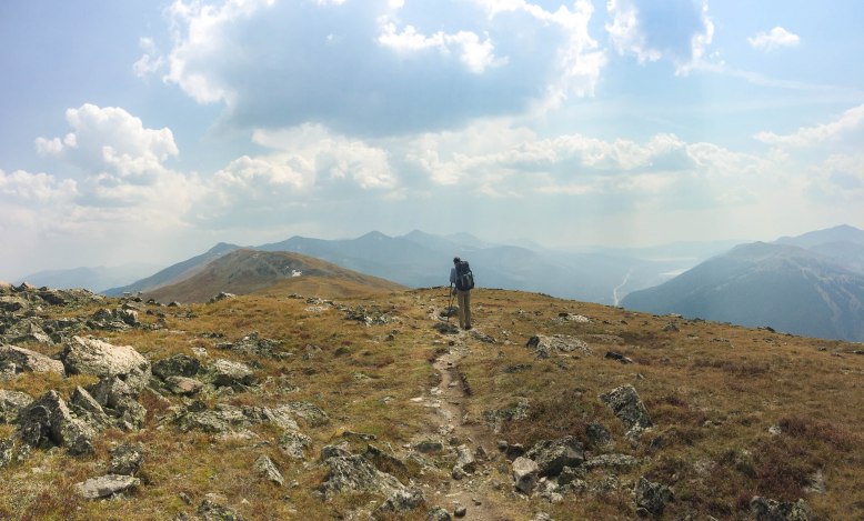
Breckenridge to the East and Copper Mountain to the West at 12,500ft!
We got off the trail shortly after starting segment 8 of the Colorado Trail in Copper Mountain. We took the free shuttle back to Frisco where a warm shower and dinner was waiting for us. As we arrived earlier in the day, we went to a matinee showing of IT.
To wrap up the trip, we also went with Michelle to the Denver Museum of Nature and Science before she flew back to Wisconsin.
Another great trip in the books. We’re looking forward to some more hiking of the AZT in the upcoming few weeks. Happy trails!
